Pembrokeshire Landscapes ...
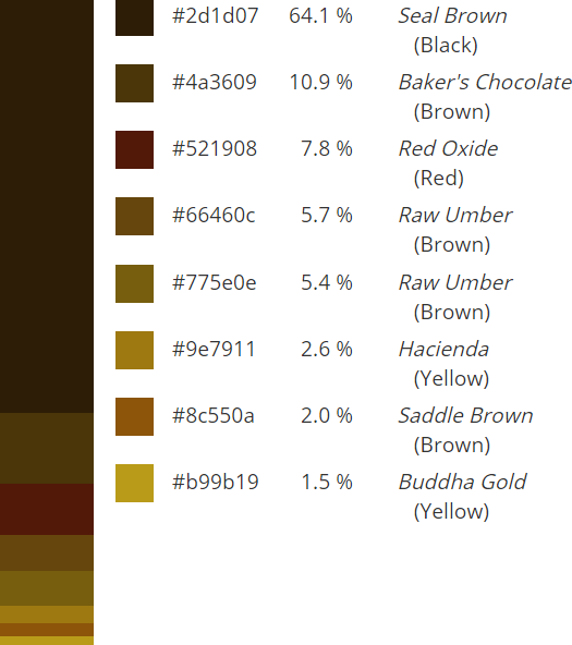
The images on this page are supported by colour analytics as an aid to interior design. Click on the icons to reveal proportional palettes, hexadecimal codes and colour labels.
Click on the images to go to our Merchant/Affiliate and a choice of size and presentation options. Our personal choice is 'Framed Mounted prints'.
Click on the images to go to our Merchant/Affiliate and a choice of size and presentation options. Our personal choice is 'Framed Mounted prints'.
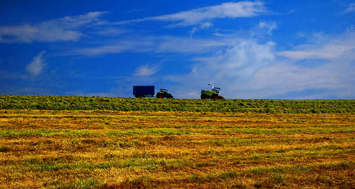
Pembrokeshire is a predominantly agricultural county, with a mix of arable, dairy, beef and sheep farming. This makes for rich and varied landscapes along the coastal hinterlands, with multi-coloured patchworks of pasture, cereals, root crops and brilliant oilseed rape. In contrast, the sparsely populated uplands can boast no more than a scattering of sheep, grazing between the moorland outcrops and the vestiges of worked out stone quarries. The landscapes vary with the seasons and the moods change with the changing weather.
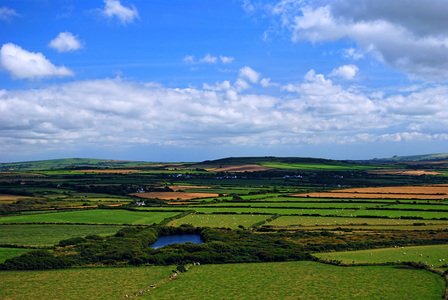
Pembrokeshire Pastoral #1. Looking across the farmlands of Pen Caer towards Dinas Mountain on the far right horizon. The irrigation pond gives a point of focus. Click on the image for purchase options.
|
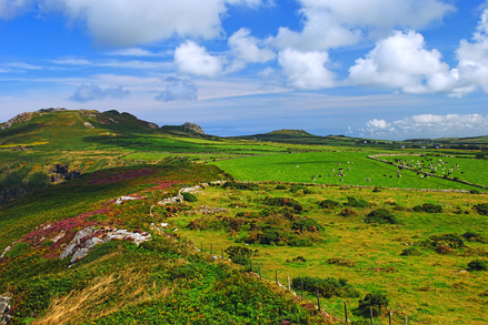
Pembrokeshire Pastoral #2. Cows may safely graze ... below Garn Fawr and Garn Fechan. The stone hedges segregate the pastures from the coastal moorland and the high cliffs of Strumble head. Click on the image for purchase options.
|
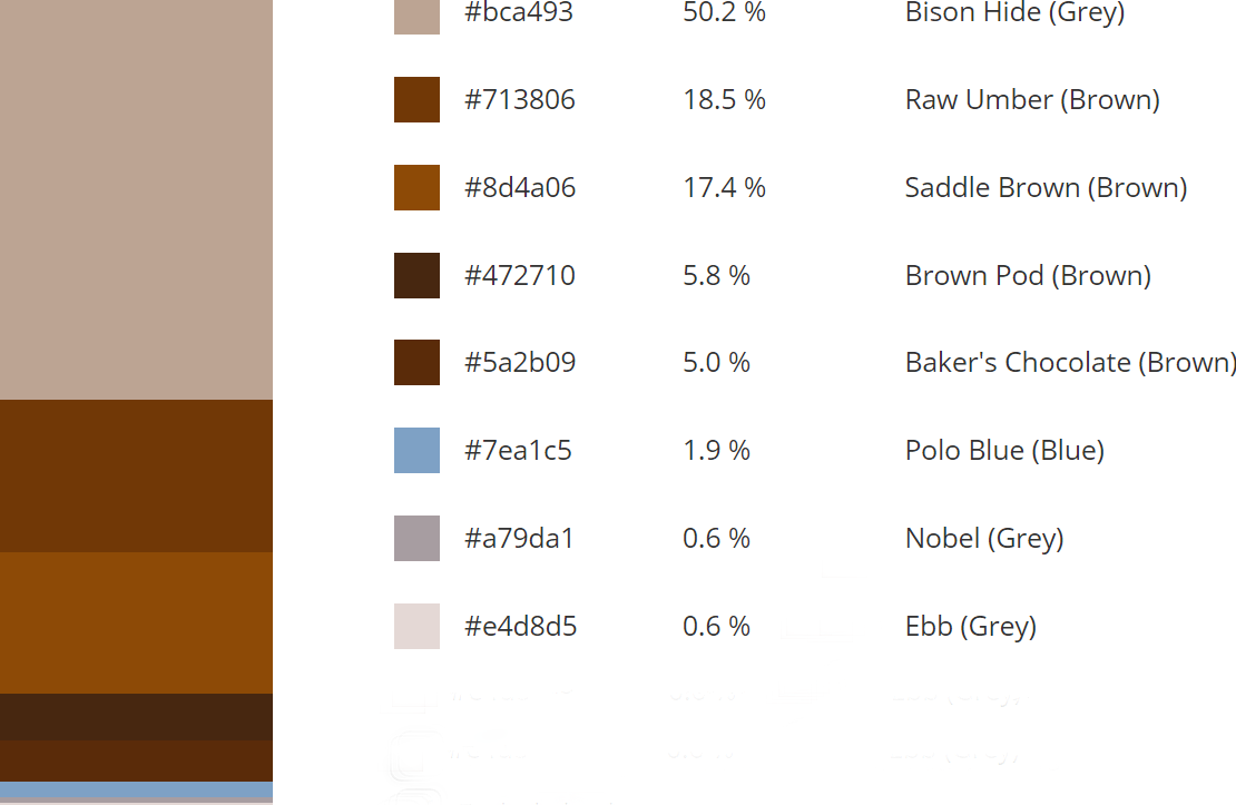
Colour Palette
|
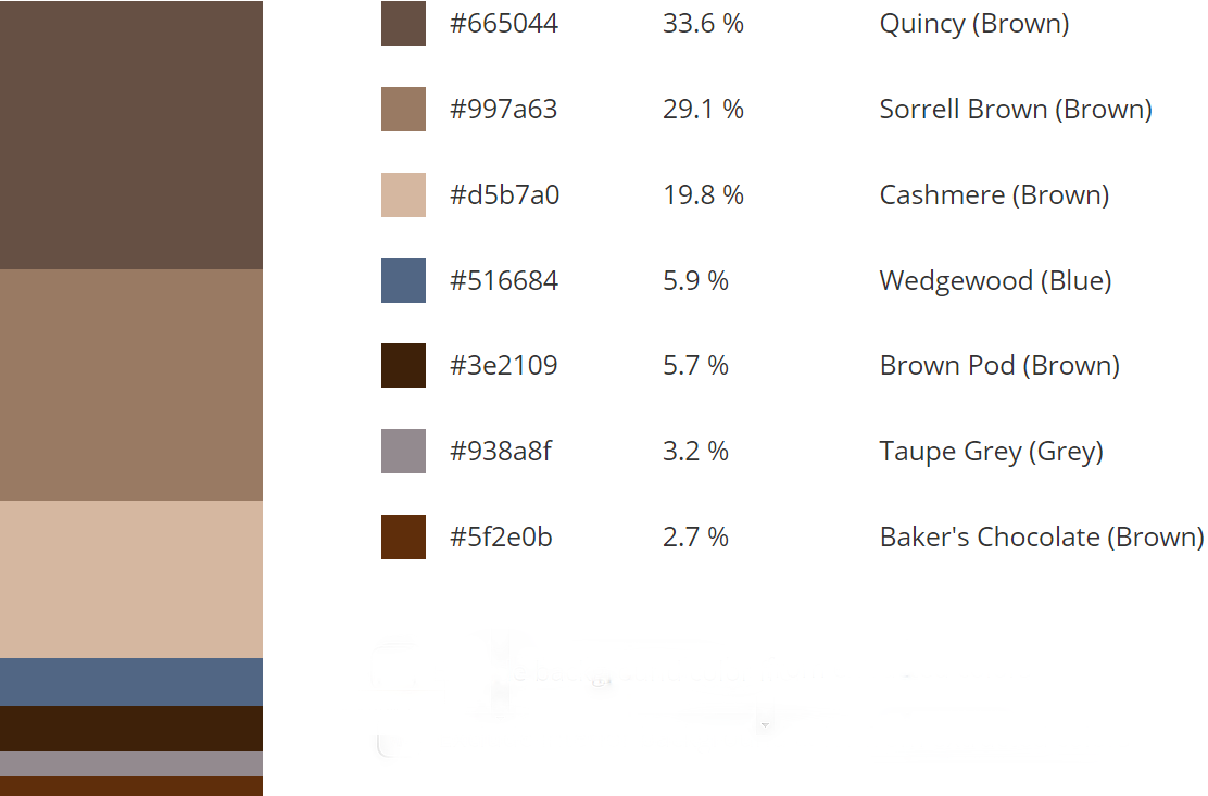
Colour Palette
|
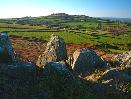
Pembrokeshire Pastoral #3. Pen Caer from Garnwnda. The farmlands on Strumble Head saw the last invasion of Britain thwarted by Fishguard women in traditional dress. The finger stone marks the location of an earth-fast burial chamber. Click on the image for purchase options.
|
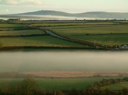
Pembrokeshire Pastoral #4. Dinas Mountain at dawn. Captured from the south west. Mist fills the valleys of the Fishguard Bay hinterland and the early light gives texture to the fields and brightens the horizon. Click on the image for purchase options.
|
Colour Palette
|
Colour Palette
|
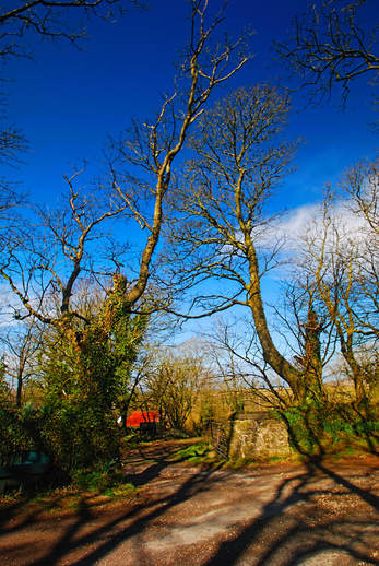
Pembrokeshire Homestead. The back lanes of North Pembrokeshire weave from farm to farm in defiance of cartographic logic. They were created to allow co-operation and sharing of resources by neighbours: grazing, crops and in these days machinery and manhours. The byways pre-date the internal combustion engine by centuries, even millennia. This particular holding is documented in the first local records following the Norman Conquest but the site was inhabited long before then.
Colour Palette
|
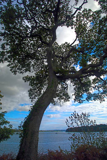
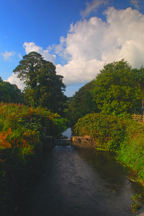
Milford Haven Waterway. The Waterway at Lawrenny, framed by bankside growth of almost oriental starkness. The Waterway, Daugleddau in Welsh, is formed by the confluence of the Eastern and Western Cleddau Rivers and is one of the finest deepwater havens in the UK. The Waterway is marked by its many inlets ('pills'), of which this is one, and which gave maritime access for the Norman expansion, helped create a major fishing industry (now defunct) and helped oil the wheels of the industrial revolution locally.
Colour Palette
|
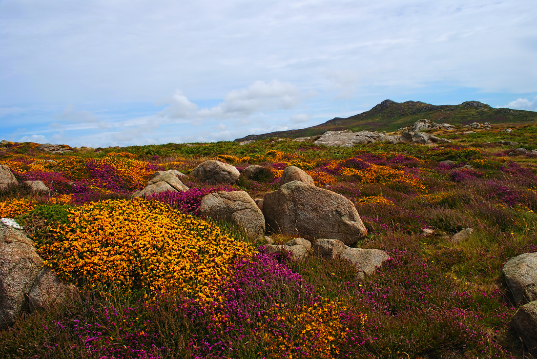
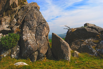
The Moors at St Davids Head. Splashes of colour among the boulders. The land rises towards Carn Llidi, overlooking Whitesands Bay. Click on the image for purchase options.
|
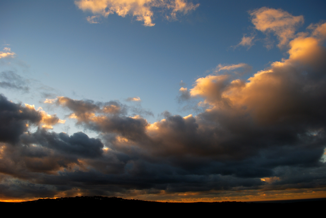
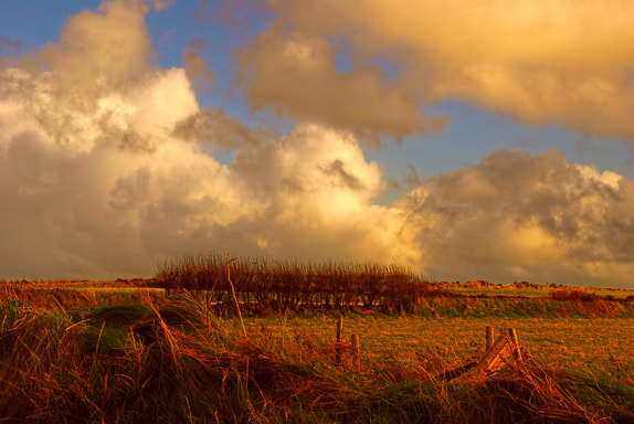
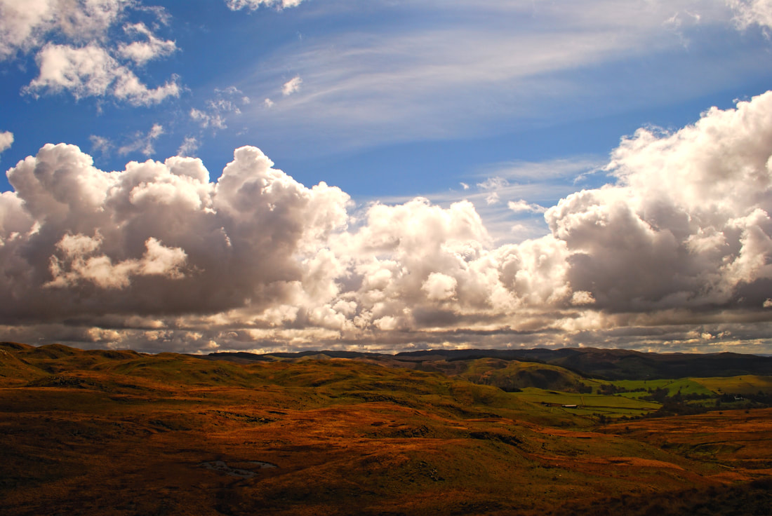
Storm Skies. A stormy sunset over the hilltop village of Mathry, captured in late November. Heading for home after a cold day in the Preselis. Click on the image for purchase options.
|
Colour Palette
|

Colour Palette
|
Preseli Backdrop. All eye lines lead to the Preseli Hills on the horizon. Captured above the Gwaun Valley in mid September. Clock on the image for purchase options. (B&W conversion is available.)
|
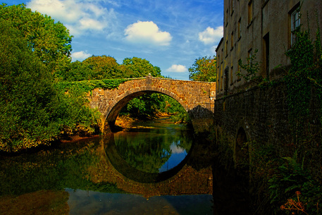
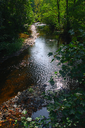
Blackpool Bridge. The elegant 19th Century bridge spans the Eastern Cleddau, which marks the boundary of Slebech Park at this point. The Park was originally part of the estates and Commandery of the Knights Hospitaller. Click on the image for purchase options.
|
Colour Palette
|
Colour Palette
|
First Cut, Longhouse. Taken from the Wales Coast Path east of Abercastle, North Pembrokeshire. Longhouse Farm is the site of Carreg Samson, a Neolithic burial chamber overlooking Fishguard Bay. Click on the image for purchase options.
Berea Sunset. The westering sun brings dramatic colours to the moorland and cloud cover, a couple of miles inland from Abereiddy on the Pembrokeshire coast. Click on the image for purchase options.
Colour Palette
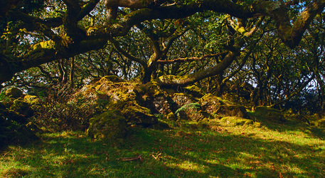
Tŷ Canol Ancient Woodland. The 'wood pasture' has been grazed by sheep, cattle and ponies for millennia of human habitation, allowing light to infiltrate the canopy. The result is one of the largest colonies of mosses and lichens in Britain and Ireland. Managed by Natural Resources Wales in partnership with the Pembrokeshire Coast National Park. Click on the image for purchase options.
|
Tŷ Canol National Nature Reserve. Taken from the footpath leading down to the extensive ancient woodland. Close by the hamlet of Brynberian and the Neolithic cromlech at Pentre Ifan. Click on the image for purchase options.
|
Colour Palette
|
Colour Palette
|
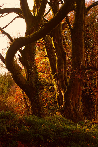
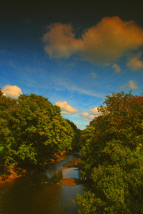
Little Milford Woods #1. The creeks and pills that feed the Daugleddau are rich in ancient woodland. The first of three autumnal captures. Click on the image for purchase options.
|
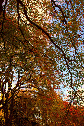
Little Milford Woods #2. A second capture of the woodland in autumn. Click on the image for purchase options.
|
Colour Palette
|
Colour Palette
|
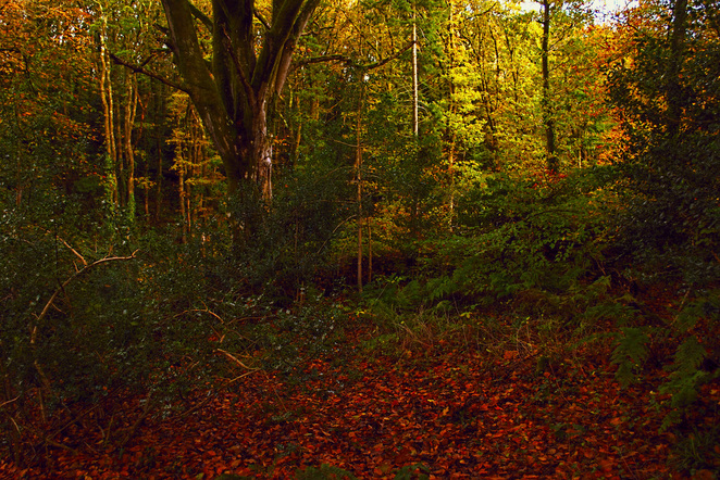
Little Milford Woods #3. The third of three captures from the ancient woodland that descends to the big bend of the Western Cleddau downstream of Haverfordwest and below the village of Lower Freystrop, Downstream again is Picton Point and the confluence of the Western and Eastern Cleddaus. Completes a nice set! Click on the image for purchase options.
Colour Palette
The Eastern Cleddau River above Blackpool Bridge. Hints of impending autumn. The eastern and western branches of the Daugleddau (Milford Haven Waterway) meet a few miles below this stretch, at Picton Point. Click on the image for purchase options.
|
Afon Anghof at Wolf's Castle. The river joins the Western Cleddau just downstream of this point. A secret spot with a motte and bailey fort. Click on the image for purchase options.
|
River Solva at Middle Mill. A few miles above the harbour and estuary at Solva and the sometime power source for Solva Woolen Mill, established in 1907. Click on the image for purchase options.
|
Colour Palette
|

Colour Palette
|
Colour Palette
|
... and a little bit of Ceredigion
Sometimes we stray away from The Shire!
Teifi Headwaters. The River Teifi rises in the high uplands of the Cambrian Mountains at the cluster of lakes around Llyn Teifi. Together, Llyn Teifi, Llyn Hir, Llyn Gorlan, and Llyn Egnant, make up the Teifi Pools, set in a distinctive and otherworldy landscape, a micro-climate of constantly changing skies, muted colours, storm-fed mists and rain; nothing is permanent, all is transient.
|
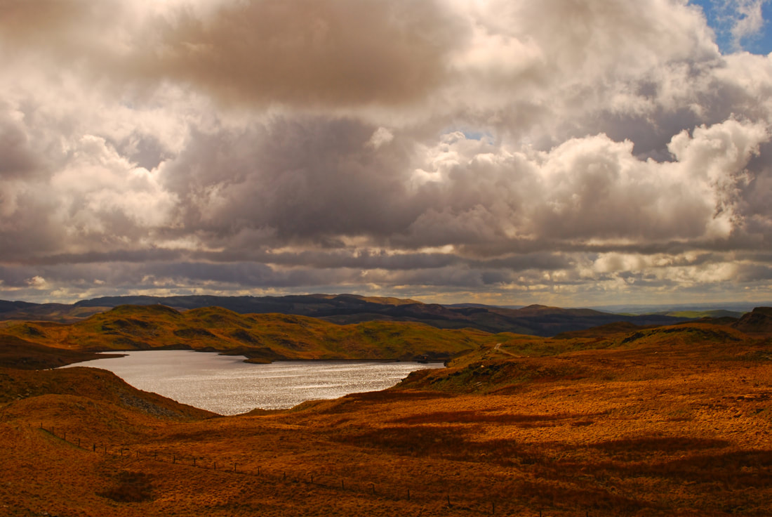
Llynn Teifi. The largest of the cluster of lakes that make up Teifi Pools: Llyn Teifi, Llyn Hir, Llyn Gorlan, and Llyn Egnant. The River Teifi has its source high in the Cambrian Mountains in this distinctive landscape, under skies that are more often than not heavy with imminent rain. Far on the horizon is the blue line of Cardigan Bay. The Pools can be reached by a small road from Ffair Rhos, close to Pontrhydfendigaid, running to the north of the pools.
|
Colour Palette
|
Colour Palette
|
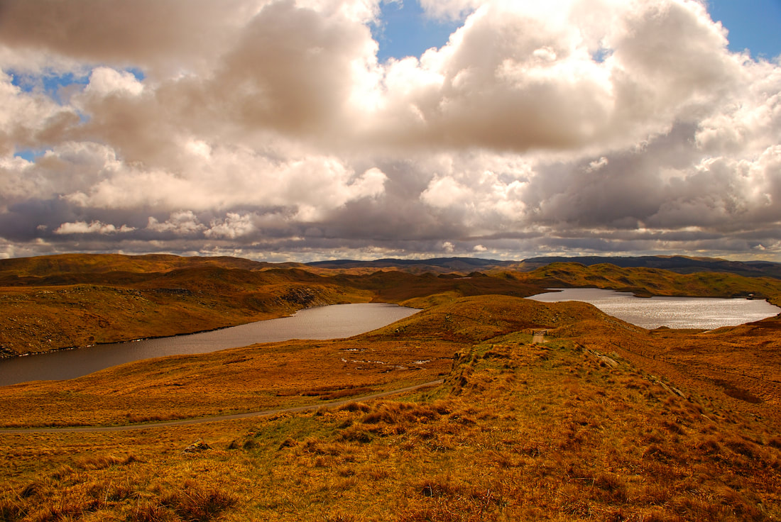
Teifi Pools. The source of the River Teifi is high in the Cambrian Mountains at Teifi Pools. The cluster of lakes, Llyn Teifi, Llyn Hir, Llyn Gorlan, and Llyn Egnant, sit in a sodden peat landscape under brooding skies.
|
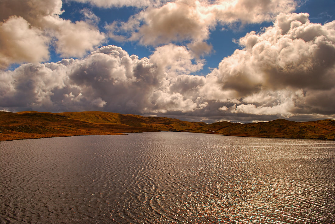
Llyn Teifi, Detail. The primary source of the River Teifi is Llynn Teifi, the largest of the cluster of lakes that make up Teifi Pools: Llyn Teifi, Llyn Hir, Llyn Gorlan, and Llyn Egnant.
|
Colour Palette
|
Colour Palette
|